Tag Archives: appalachian trail

Appalachian Trail – GR Thompson WMA

Posted on

Hike Summary

I’ve been a terrible blogger, again. I have two drafts, sitting in the queue, that almost seem silly to try to publish. It’s been almost two months … again. Just like last year around this time, I got caught up in training, and so tired that I never seemed to find time to update.

I shouldn’t dwell upon failures though, I should just push forward.

It does bother me, though. This cycle of procrastination that I get in. If I cannot maintain my own blog, what hope do I have that my new opportunity, doing some volunteer social media stuff that maybe, just maybe might work into something real … what hope do I have that that will work?

My life is an endless series of self-sabotages. Ah well. I kinda want to just delete this all and start over with something more positive, but I won’t. Naught to do but push forward, get back on the horse, and so on.

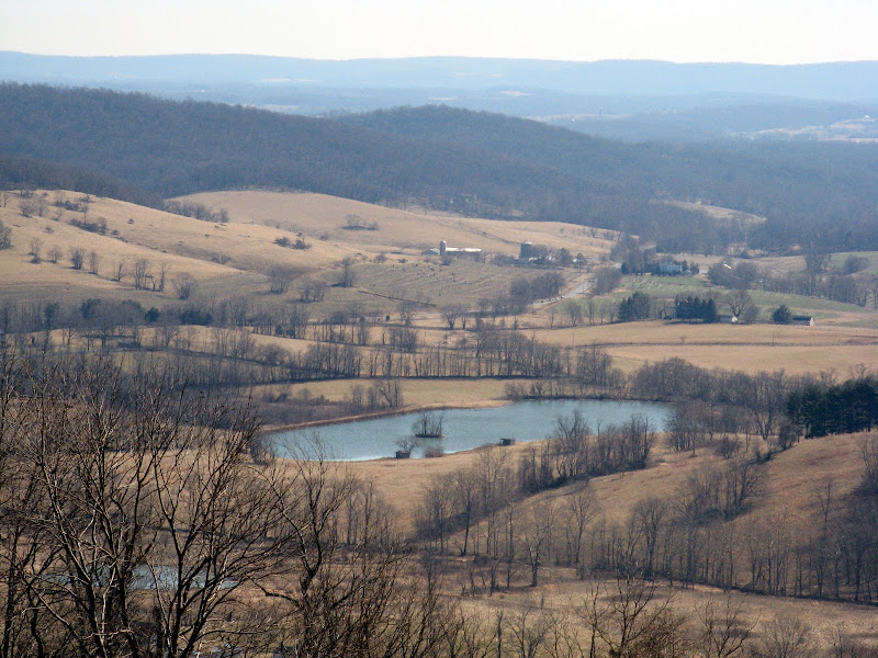
So, GR Thompson WMA is a state-maintained park of sorts. It’s not a state park, but more akin to a state forest … but it isn’t one of those either. It’s basically a state-maintained wildlife preserve. So, if you want to fish or hunt, this is one of the places that you’d go. The Appalachian Trail also happens to go through it. I’ve actually hiked most of the AT section before – last June, during National Trails Day. I’ll be back to this same area again, this upcoming day.

Maybe I’ll be a better blogger and post about it!

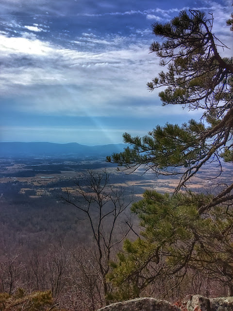
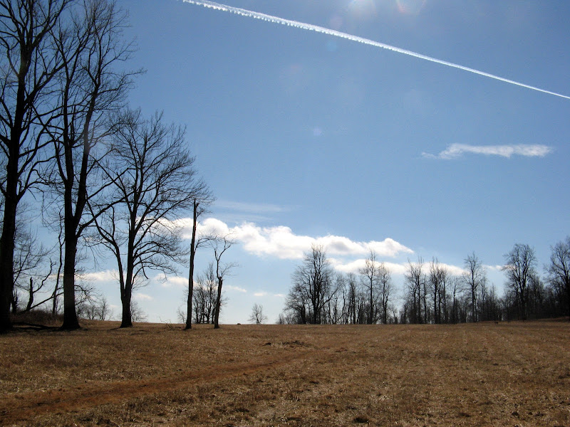
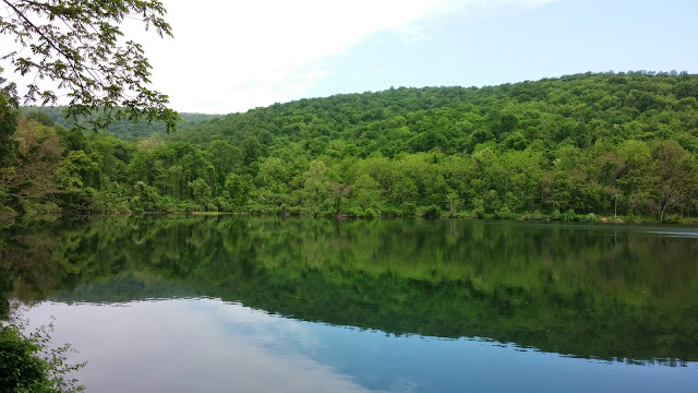
So anyway, this hike starts out at the Thompson Lake parking lot, which is nice and spacious. There’s a little road that leads up to a second parking lot with handicapped parking and a boat loading ramp. I had two choices – go straight, or go left. I chose to go straight. The trail led uphill for quite a good ways, passing in and out of shadows and light. The day started out hazy and a little bit overcast, but by the time I reached the top of a ridge behind a vineyard, the sky was blue and the sun had come out nicely. It seemed like it was going to be a pretty hot day.

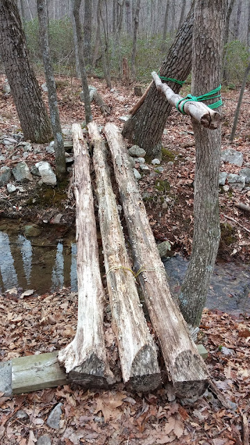
The ground was pretty wet in places, and on one part of the trail where it went across a stream, the trail itself had become a little bit of a river, which make going a little bit slippery, but otherwise not too bad. There weren’t too many insects out yet, but there were quite a lot of wild geranium, lining the trail with their purple blossoms.

This wasn’t actually the flower that I’d come to this place to see, but they were a pleasant surprise nonetheless. The biggest reason I’d come was to see the trillium.

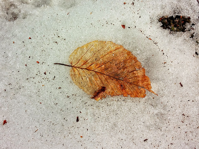
Trillium grandiflorum. The great white trillium. They’re one of those wonderful spring ephemeral plants, along with Virginia Bluebells, that only have a quick window in order to be seen. I missed them last year, and I wanted to make sure that I was able to catch them this year.

At first, I thought that I had failed. All I saw were shriveled up flowers, all over the place. I was a little bit disappointed. I thought to myself that it wouldn’t be until next year that I would get my next chance, and I was a little bit bummed out as I turned into the Appalachian Trail.

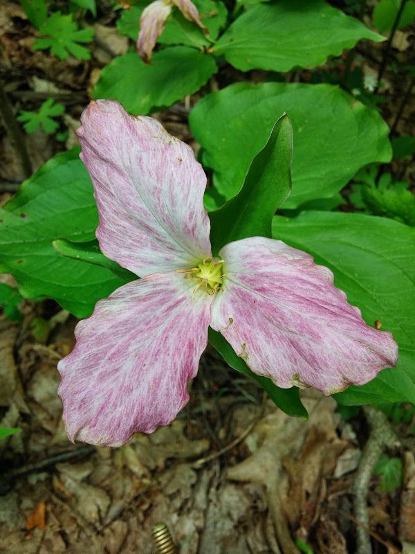
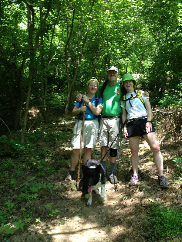
However, as I hiked along, I started to see ones that were in better and better shape, and then I saw an almost perfect one. I was pretty happy. I also encountered a few AT thru-hikers, all of them a bit faster than my dog and I, especially since I have a habit of stopping often to take pictures.

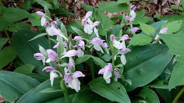
Trillium weren’t the only flowers out this day. I also saw mayapple in bloom (you have to look under the large leaves to see the flowers!) as well as jack in the pulpit and showy orchis. There were even plenty of violets and some blackberries in bloom – I may have to make a late summer blackberry picking trip.

I stopped at Dick’s Dome shelter for lunch  and chatted with another thru hiker who wasn’t sticking around very long. He asked me for the weather forecast, which I happily provided (chance of thunderstorms, which never materialized.) I backtracked to the side trail that led back to the lake.

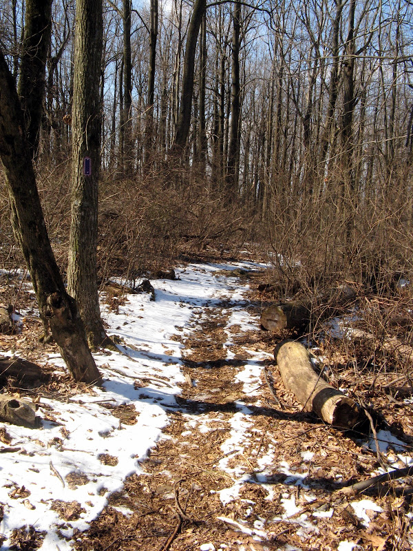
You can tell that this trail is rarely maintained, because I ran into quite a few deadfalls, one of which required getting on hands and knees (and fairly muddy) to get through. There was no real way around it otherwise. One of the things I did notice though is that, even when a tree is knocked over, it does still try to reach its way back up. I guess that’s something I should remember myself.

GR Thompson WMA

Tuscarora Trail to Kepler Overlook – George Washington National Forest

Posted on

Hike Summary

This particular day for this hike was forecast to be such a nice day that I felt it was criminal to not go for a hike. So, despite a little bit of ankle pain (from ODH training) I picked a region I hadn’t been in a while.

Good old George Washington National Forest. You are my old and I think bestest friend, followed closely by Shenandoah and the AT.

GWNF, with your obscure trailheads, your barely visible blazes, your rules allowing me to let my dog off the leash. Your rustic sensibilities, your frequent campsites, your dirtiness. Who knows what manner of moonshiner or pot grower lives within you, as long as they don’t decide that I’m an intruder.

Finding the trailhead was an adventure, as trailheads usually are here. There are some really nice cabins and houses back in these obscure folds of land in Virginia. I assume that a lot of them are seasonal hunting lodges, or just people who like living somewhere that there aren’t people out to bother them. The first part of the drive up from Woodstock, up Zepp road, was pretty, with nice views. Then at some point it devolved into almost single-lane gravelly road, which is totally fine with me (although probably not so much my car’s alignment.) Finally, we end up at a pretty decent parking area with campsites, and a little connector trail/gate gravel road out to the Tuscarora Trail.

I really do want to backpack the Tuscarora Trail someday. It is a trail with a lot of character, the way it goes over the various ridges and makes a big western arc to and from the AT. It took over the path of several other trail names, so it retains those names in its own name as it makes its way through VA and WVA before turning east into PA. There are a few shelters like for the AT, but it’s mostly pretty much on your own for finding places. I’ve noticed quite a lot of camping spots though, so that seems pretty easy.

The day started out pretty grey and overcast, but warmed up as I went along. The first part of the hike is pretty easy, and there’s a nice campsite along Cedar Creek where I cross it. The trail follows an old ore road up the mountain, and then there’s another extremely … creative bridge over the creek again.

My dog has more sense than I and just fords the water. I hold onto the railing and make my way across the rickety thing, worrying all the while that it’s going to fail on me and I’m going to fall in.

This is not to be. I am safe and sound as we continue up the trail. Things look like they’re all thawed, but then I encounter an area that is pretty much all still snow covered. It’s a little slow going, as things are icy and even with my nice boots things are either slippery, or like hiking through sand dunes. Eventually though, I make my way through the winter wonderland and up to the top of the ridge.

There’s an excellent view of the Shenandoah Valley from here, along a ridge/cliff of rock. There are several campsites along the area, and someone has helpfully nailed a thermometer to a tree, allowing me to check out the current conditions.

58F. Not bad.

It was still pretty hazy up there, but the sun was coming out here and there through the clouds, so I spent at least an hour relaxing up at the top, enjoying the view. I scribbled in my journal, taking notes on the hike so I don’t forget when it comes time to sit down and write. There’s a really nice fire ring with seating there, so it made it extra easy to linger.

I thought about adding some extra miles to the hike, but my ankle was still a little sore from the hike (plus the next day I foolishly went for another hour long walk instead of doing nothing,) so I figured it was a bad idea to push things. It was time to head back.

On the way out of the area, I decided to try to find Van Buren Furnace, which is another one of those pig iron furnaces that dot this region. I found it, but oddly there was a “No Trespassing, Private Property” sign. It struck me as odd, because it’s supposed to be on an acre of forestry land. I suppose the locals were just trying to keep people like me away.

Kepler Overlook

Appalachian Trail – VA 605 to Rod Hollow Shelter

Posted on

Hike Summary

The Appalachian Trail, or the AT, as most people who are familiar with it, winds 2000 miles from Georgia to Maine. Most of it lies within driving distance of much of the population of the east coast.

Sometimes I’m a little surprised that more people don’t know about it, but then again, most people don’t hike as much as I do, or aren’t into hiking as much as I am. I was recently listening to the Nerdist Podcast where they were interviewing Michael C. Hall (of Dexter and Six Feet Under) and I was a little surprised when the host seemed unaware of what kind of hike the AT was.

Unfortunately, because of Mark Sanford and his infamous “I was hiking the Appalachian Trail” remark during his scandal, the AT trickled into the consciousness of pop culture as the butt of a joke. I cannot tell you how many times  I’ve mentioned to people that I’m hiking on the AT, only to get references to Sanford or other giggly responses.

The AT is so much more than that. It’s a trail, yes, but sometimes I think it’s much more than that. It’s a link that crosses all those states and although it often goes over terrain that really just wasn’t wanted, it goes through some remarkable places, and affords wonderful views.

Although on this particular day, I didn’t really hike anywhere that was all that remarkable, view wise. I hiked a section of the AT that is famous (or infamous) amongst hikers: The Roller Coaster.

The Roller Coaster section (or, the part I hiked of it, about half,) winds up and down hollows, in an area that’s more or less unremarkable. There aren’t really any views at this time of the year because of the leaf cover, and it’s mainly just a hike of endurance, knowing that beyond one hill is another hill, over and over until the other side. It’s sort of numbing, even with a day pack, I can imagine it is probably pretty unpleasant for thru hikers.

Still, let not my description fool you, there’s still plenty of things of interest along the way. It’s getting on in the summer, but there are still wildflowers about, particularly in the wetter areas. Berries are starting to ripen, but not along this area, I’m sure there are more to the south in Sky Meadows and GRT.  There are some solid rock formations, and I found a nice one and a shaft of sunlight to sit in for a time while I was out. I didn’t actually want to leave the spot, it was so pleasant. Those big jutting rocks must have been awful for farmers, but I find them now to be like little islands amongst the sea of foliage. They bring to mind gongshi, Chinese scholar rocks.

Hiking overall is a bit of meditation for me. I leave the modern world behind. I (for the most part) put the trappings of civilization away, or at least stow them in my pockets or pack, unused except to take photographs or find my way. I generally try to avoid using my phone except to keep loved ones updated with my status.

I leave my mind open, quiescent. Whatever trickles into my thoughts does so, and I try to look at it and then let it go. This way it helps my mind to decompress from my stresses and frustrations. Sometimes I wish I could spend all of my time on the trail, because of that sense of tranquility I get. I am often envious of the thru-hikers I encounter, although I suppose they’re just as envious of the ability I have to go home and take a shower and sleep on a mattress.

After the Roller Coaster section of the trail, I went a little further to Rod Hollow Shelter, one of the many shelters along the AT. I’d been here before back in March, and it was for the most part unchanged. A little dryer, a little stinkier, but still a pleasant place to stop and eat a snack. I saw some gorgeous Cardinal Flowers. They’re fairly ephemeral, but when seen they really are quite a show.

The return trip was much the same. The same up and down undulation of hill and hollow, with just myself and my dog. The other hikers I’d encountered were long gone, on their way to Bear’s Den or other points north on the trail. I wish them well on their journey to Katahdin.

For me, it was a trip back home, although I found a new ice cream stand to stop at. It’s called Bears, and it’s in the middle of downtown Marshall. It wasn’t stupendous, but it wasn’t bad. Ice cream, in my opinion, is like sex or pizza: Even when it’s bad, it’s still pretty good. They did have some pretty awesome street art for their place, although it didn’t … quite match the name.

2013-08-09 Ashby Hollow

White Oak Canyon & Cedar Run – Shenandoah National Park

Posted on

Hike Summary

With the previous week having been so hot, I had been worried. Would it be another sweltering day? Would the weather just not cooperate?

The weather exceeded my expectations. It was so mild that I actually thought I might need a sweater when I awoke, and tossed one in the car, “just in case.”

It was just such a fantastic day, it was as if someone had smiled upon me and gave me beautiful weather because it was my birthday, and they knew it was a special hike.

White Oak Canyon trail is probably one of the most popular trails in Shenandoah National Park. You get to see one of the prettier waterfalls, and it has multiple cascades. If you’re a fan of water falling vertically downhill, this is the best trail to go on.

I started out from the bottom, at Berry Hollow. The trail winds through forests before starting an ascent ever upward. There were quite a few hikers, even during a weekday. I wasn’t totally surprised, because it was the first gorgeous day in a couple of weeks, and it is the most popular trail in the park.

Even though it’s midsummer, I saw plenty of wildflowers, and was stopping pretty often to take pictures. I leapfrogged along with a pair of hikers up to the lower falls, which were quite pretty.  There was another group of hikers, a family, behind me, but they turned around before the upper falls, which surprised me.

The upper falls were quite beautiful as well, although I don’t like going near cliff edges too much, I was able to take some pretty shots. It’s a testament to how popular this place is, that there are paved steps along parts of this upper trail. There are also signs warning people that the hike is strenuous (which it is) and to not overdo it. One of the things I did enjoy was for me, how much easier it seemed to get uphill compared to the other hikers. This was a change from Big Schloss, where I felt like I was the slowpoke.

I passed a couple more hikers and pointed out the nice vista to them as I went along. Once I got to the big junction of trails, I decided to take a route that was longer than normal, and continued up White Oak Canyon trail, until it intersected with the Limberlost trail.

The Limberlost trail was quite pleasant, gravel with a lot of benches along the way. I stopped at one of the benches to eat a snack, and I watched an Eastern Comma butterfly flitting around the sunny area. At this point I really didn’t see any other foot traffic at all, and in continued along the way, turning on the Crescent Rock Trail.

One thing I had done with this hike, because I wanted to go on a longer track than most of the hiking sites around, was modified the route to include these extra trails. I was a little bit nervous about doing this, because it seemed like there were slightly complicated intersections, but it seemed that I got it really almost perfectly. All the turns that I put in there were at the right places, and my GPS unit beeped it’s reassuring chime, alerting me that the trail I was on seemed to be on the right path.

I reached Skyline and started to cross, and about 500 feet away, a pair of black bears decided to do so as well. I pulled out my camera, but unfortunately all I got was a brownish blur in the distance. The traffic along the road got a much better look, and I think I’m pretty happy I wasn’t any closer, to be honest. I’ve had the good luck to have had all my encounters to be at a safe distance.

I crossed and took a connector down to the AT. As I ventured down below the Crescent Rock overlook, I saw quite a few pretty wildflowers, including a Purple Flowering Raspberry, which has one of the prettier flowers out there.

The trail wound out of the sun and into the gloom, and the footing was rather rocky but overall pretty even. I wasn’t on the AT for very long, cutting over at Hawksbill and heading down Cedar Run Trail.

Cedar Run Trail is pretty similar to White Oak Canyon trail, although to me it felt much steeper. This might also have been because by this time I was starting to get a little tired, and sometimes it feels like going downhill when tired is actually more difficult than going uphill.

The one major difference is Cedar Run’s falls are more swimmer friendly. There are quite a few swimming holes along the way, and I saw swimmers both leaving and heading to the falls. Since it was later in the day, and I had no swimming suit with me, plus a dog who isn’t enamored of the water, decided not to partake.

However, there was at least one crossing of Cedar Run that made me decide to take my boots off and wade across. The water was ice cold! It did feel good though, and I took my time and enjoyed the feeling of cooled off feet before I put my boots back on. There’s even one swimming hole that has a natural waterslide, hence the nickname “the slide.”

Finally, the trail leveled off and I was back to the parking area, where I saw a stand of wineberries which I ate a few of. It was a long hike, and I think the next time I will pare it down from 10 miles to the shorter 7 miles, but it definitely deserves its reputation as being one of the best hikes in the park.

2013-07-25 White Oak Canyon & Cedar Run

Appalachian Trail – G. Richard Thompson Wildlife Preserve

Posted on

Hike Summary

(Note: I didn’t get to take any pictures on this hike due to the pace, so you get lots of words!)

So, June 1st was National Trails Day, so what better way to celebrate than to go on a hike?

I often go just with my dog on hikes, as there are very few people with time off during the week, which works both in my favor and against me. It works in my favor in the respect that I don’t often encounter other people on the trail, but it works against me because there aren’t any people to hike with. My SO has an aversion to the outdoors for the most part, as well as being afraid of heights, so he’s mostly unable to go hiking with me. That’s totally fine with me, we have different interests and hobbies.

Still, I have made close to zero friends since I have moved to the East Coast. A good chunk of that is my depression and social anxiety, but it just seems to be hard to meet people. Most of the meetup type organizations in the area seem to be stay at home moms, and since I am only a mom to a dog, I don’t exactly qualify.

Anyhow, I wanted to get out and meet some new people. This is probably something I would have been much more nervous about doing even a year ago, but it seems that shedding the weight that I have has also helped a little with confidence. I’m not there yet by any means, but I’m getting better.

So, to the hike. I arrived fairly early, not wanting to be late, and there were a few cars in the lot, and one guy and his dog. This was Tom Johnson of the Potomac Appalachian Trail Club, one of the hike guides for the day, and his dog Sam (a girl.) She was an enthusiastically friendly and intense Aussie Shepherd/Border Collie mix. We chatted for a while, waiting for the others. It ended up being a very small turnout, with Alyson Browett of the Front Royal/Warren County Appalachian Trail Community, and another  hiker named Bob.

We set out in one car to the starting point of the hike, at the other end of the G. Richard Thompson Wildlife Preserve, which is one of a multitude of Wildlife preserves in the state of Virginia. It is open for fishing and hunting with permit, and is an excellent place to view bird migrations as well as wildflowers. A good chunk of the Appalachian Trail bisects the area before heading into Sky Meadows State Park.

It was a pretty warm day that day, but not overly so. Most of the trillium were long past their season, something I’ll have to remember for next year. I remember seeing them before they bloomed in Sky Meadows in April, so it seems they have a narrow window of blooming.

We did see quite a bit of wildlife though: several toads, squirrels, a box turtle, and even a black racer. Luckily we did not see any Copperheads, which used to live underneath the Manassas Gap Shelter, where we stopped for a snack and to chat. Manassas Gap Shelter is the oldest of the AT shelters between Shenandoah and the WV border, so it has a long history. As we were chatting, we met an AT thru-hiker who went by the trail name of Goose. He’d been on the trail since early March, and was making excellent time, living off mostly Pop-Tarts.

As we hiked on, we chatted about the trail, stopping to check out trees and plants. It was nice to have other people who knew more about the  flora than I did. I can identify any number of California native plants, but I am definitely still learning my Virginia wildflowers.

Near the end of the hike, Bob was kind enough to snap a picture of us for posterity. I had a great time, and really enjoyed hiking with more people. Hopefully I’ll get a chance to do so again soon.

Loudoun Heights at Harper’s Ferry

Posted on

Hike Summary

I recently finished reading an excellent book: John Brown, Abolitionist, by David Reynolds. Since I had been steeped in so much history, and since the guys a HikingUpward had recently posted a new hike from Harpers Ferry up to Loudoun Heights via the AT, I figured it would be a good time to go visit.

Spring has given way to Summer, and this was a scorcher of a day. I managed to completely luck out and get a parking spot at the downtown parking lot (something I can’t imagine will ever happen again,) and I set out.

Harpers Ferry itself is almost entirely National Park, with most of the buildings serving as museums or commercial locations. I’m not sure anyone actually lives in the town, most people live nearby in Bolivar, WV. I followed the AT through down, passing by St. Peter’s church, the ruins of St. John’s church, and Jefferson Rock. You really can throw a rock and hit a historic site in this town.

John Brown himself held the armory for several days in 1859, his fort is still standing and serves as a museum site, and is one of the more popular attractions in town.

The day was really sweltering, and I was drenched in sweat for most of the hike, and I also had the unfortunate luck to forget my bandanna. Most of the hike was shady, but there were a few spots that were under the hot sun, and both I and my dog could feel the effects.

Passing on the AT over the Route 340 bridge was one of these spots. The sun beat down, but the view of the Shenandoah River was quite nice, nice enough to make me want to go down for a swim.

Then came the hill. Obviously, Loudoun Heights implies that it is indeed upon a hill, and so up a hill we went, following the AT on switchbacks, going up some cliffs above route 340, and along through the woods. I met a couple of day hikers, who asked me if I knew where the WV state line was. I confirmed on my GPS unit that it was along the Loudoun Heights trail, which was where I was headed, not far from where we’d met.

At the Loudoun Heights trail, there was a bit of up and down, with a few bits of clover flowers and the ruins of some Civil War Era fort emplacements. It isn’t as well documented with signage as Maryland Heights on the opposite side of the gorge. As with the view from that side, this side was quite impressive, seeing the rivers merging together, and seeing all the buildings below like little toys.

On the way back, I started humming the tune to “John Brown’s Body,” (better known now as the Battle Hymn of the Republic,) and gave in to the tradition of making up new and inventive lyrics:

“When we get to Harpers Ferry we’re going to eat us some ice cream”

“Oh yes, we will indeed!”

I had spied the two frozen custard stands on High Street, and when I made my way back into town, I stopped at The Coffee Mill and got some for myself and my dog. The prices were a little steep there, but it was totally worth it. The dog and I were both incredibly happy at the end.

Harpers Ferry Loudoun Heights

Appalachian Trail – Ashby Gap to Rod Hollow Shelter

Posted on

Hike Summary

There are times when hikes are dreary and brown and grey, and I wonder sometimes why I’m out there. Things seem so bland, but I push myself because I’m getting some pretty vistas, or at the very least I am getting out of the house and getting exercise. Those endorphins are what seem to keep my depression at bay.

Then, there are times and hikes that are all worth it. They’re worth the rain and the mud. They’re worth the drive.

I was a little bit worried this particular morning when I went out. The sky was grey and threatening to rain, but it was also pretty warm. In the past, I probably would have made an excuse to stay inside instead of going out. This time, I just took my rain jacket with me and figured that if it rained, it would rain.

The trailhead for this particular trail is very well hidden, and I drove past it the first time, forcing myself to have to turn around and then negotiate a very steep turn to get there. Some of the reviews of this hike on Hiking Upward said that it wasn’t really that memorable of a trail and there wasn’t much to see.

In springtime, that couldn’t be more wrong. Sure, there are no sweeping vistas, no steep gullies. But I found myself stopping almost every 5-10 feet as I saw something new to take a picture of.

It started out small, just a couple of small white flowers by the path, and the everpresent Eastern Redbud. Soon though, there were flowers everywhere. The paths would be lined with Blue Violets, and then that would give way to Yellow Violets. There would be more Wild Geranium, and a patch of Virginia Bluebells off to the side. Everywhere I looked, the forest was coming alive.

Rain fell, soaking myself and my dog. It didn’t bother me as much as I thought it would, although it wasn’t a driving rain. As I continued along the trail, I came upon a section that was lined with bluebells. It was like something out of a fairy tale or a fantasy game. Around the curve was a sea of blue and green dotted with white. It was sublime, and almost overwhelming. Just that subtle presence of nature around everything, the world waking up from winter.

I continued on and made my way to my destination, the Rod Hollow Shelter along the Appalachian trail. This is one of many such shelters that exist for people making long (or short) treks along the trail. For many thru and section hikers, it comes at the end of a section referred to lovingly as the roller coaster, for the many ups and downs that one has to hike along it. I’ve hiked a couple of sections of it now and can see that it’s a pretty challenging section.

It’s a very well maintained shelter and campground, and I can imagine it’s pretty busy as the year goes along. Today, it was deserted, except for some beer cans and other ephemera of hikers. I put my own little blurb in the logbook, and left behind an unopened Clif Bar as an offering to the next person along.

On the return trip, I made my way up a side trail to a ridge. Here, there were far fewer wildflowers, and no views to speak of. The trail itself was pretty difficult to follow, there being a lot of down trees. I’m sure the PATC will be along at some point to fix those problems.

I also took another side trip and stopped at the Myron Glaser cabin, also owned by the PATC. It was locked (you have to be a member to rent it,) but the porch was accessible, and I rested a while and sat on the porch swing and listened to the wind.

On my way home after the hike, I thought to make a side trip to a bakery, but it was unfortunately closed. Instead, I went to my old reliable backup, Cupcake Heaven, for a salted caramel-chocolate cupcake. It was a sweet ending to a wonderful day.

AT Ashby Gap

Sky Meadows State Park

Hike Summary

This was not my first visit to Sky Meadows, but it is the first visit I have made since I started writing about my hikes.

The last time I hiked Sky Meadows, it was my first “serious” hike, after I got new hiking boots and a backpack, but before I got my Garmin etrex 20. It was actually this hike that inspired me to get a hand-held GPS, as using my mobile phone for navigation was something, I discovered, that was hazardous due to the short battery life.

It was also where I realized just how out of shape I was, and now I realize how far I’ve come in my fitness.

The first time I tried to hike this hike, the first hill, up Gap Run trail, absolutely killed me. I was barely able to get through, and ended up cutting my hike short, taking the North Ridge trail around and only hiking about half the distance.

What a difference 7 months makes. The hike up the Gap Run trail was still a bit of a lung burner, but I wasn’t gasping for air every 100 feet. It was a very very chilly day out, windy and cold, with a temperature of 14F with wind chill. I had to keep my jacket zipped up for the entire hike.

The trail winds uphill, past old ruins of a house, and then keeps going, with some nice views off to the west. I also saw a very unusual sight — a bright spot of green in an otherwise grey forest. A pool of water must be warmer than anywhere else, and the lush greenness really stood out to me.

On the trail wound, through some meadows, and then eventually junctioned with the Appalachian Trail. There was a bench where I was able to sit and have a little snack, and I finally saw some other hikers. They continued on up the AT, and I sat for a bit longer, sipping my tea and giving them time to build some distance on me.

I took the Old Appalachian trail side trip, and it was a nifty trail, with some snow still on the ground and nice views of I think Winchester through a clearcut section of forest. The trail wound on and rejoined the AT, and I hiked back up to the ridge.

There, I entered the high meadow sections, which were quite lovely after all the forest. I saw (but didn’t manage to get a photo of, sadly,) a herd of whitetail deer. They just quickly dashed through the meadow in front of me, causing me to pause and watch them run by, completely forgetting my camera in my bemusement.

Now it was time for some downhill bits of trail, and the ground had thawed enough somewhat that it made things a little slippery at times. As I was hiking, I encountered one of the oddest sights I’ve seen while out hiking: Another hiker, an older gentleman, who was so well dressed it completely took me off guard.

He was wearing hiking boots, as one obviously would need to, and I didn’t catch notice of his pants, but he was wearing a nice jacket and … a tie. Hiking while wearing a tie just seemed so strange to me. I was talking about it to my mom later that day and she commented that some people just like to be well dressed, no matter where they go.

I suppose this is true. It was very impressive. I wish that I could be that well dressed when I go hiking, but I end up looking like a mess most of the time, with my grubby jeans and my 3 sizes too many coat (losing 90 pound in a year has that effect, but it seems wasteful to buy a new one when this one is barely a year old.)

I hiked on, and nearer to the end of my hike, managed to accidentally flush a red fox, who quickly bounded away.

I kinda miss these hikes, with all the mileage building hikes I’ve been doing as training. I like to hike for enjoyment, and sometimes the other ones seem like more of a chore. I need to figure out a balance of entertaining and training, so that I can continue to post interesting posts and get the needed miles in.

2013-02-21 Sky Meadows

Appalachian Trail – Pine Grove Rd to Raven Rocks

Posted on

Hike Summary
So, after that marathon (for me) saga of Mary’s Rock a couple of weeks ago, I decided I should do something shorter. I had planned on hiking this last week, but of course Sandy had other plans, and I had to stay home. That gave me some extra time to recover and plan.

I decided to go on a Tuesday this week, because I was a little worried that the Nor’easter was going to drop some snow on the area (completely didn’t happen, but better to be safe than sorry!) and it was a beautiful, clear, and rather chilly and blustery day.

This is my second time hiking a portion of the AT, and the first one where the focus of the hike is that particular trail. It has a reputation for being called the “roller coaster” in the Virginia portion, and after this hike, I can definitely see why. This hike was a bit of a roller coaster in miniature, as it wound its way up and over a couple of hills before coming up to Raven Rocks.

It starts out as a little path coming off a parking lot on Pine Grove Road, at the intersection of the Leesburg Pike.  Up and down it goes, over wrinkles of hills, down into little stream valleys that had trickles of water flowing. The second stream, I never actually saw but only heard, as it burbled under my feet. It was around this valley that I saw my first AT Survey Marker, which are used to mark the right of way of the trail and as reference points.

One thing that is somewhat easy to forget, but was actually also a fairly constant reminder, is just how well traveled this trail is. I only actually saw one other hiker this day, but every time I put a hand out to steady myself on a tree branch, I could feel a smoothed down feeling. It reminded me of the railings at Disneyland, and also really spoke to just how many people travel on this trail. The occasional bits of debris and garbage are of course another reminder, and I picked up what I ran across.

I didn’t take a lot of pictures this day, I am not really sure why. I was feeling a little less motivated about my photography skills than I have been. I’ve been trying to read about how to take better photographs, but it often seems like I’m unable to put those things into practice. I think I sometimes get distracted by the fitness aspect of my hiking, and forget to take time to stop and look at things better. I need to remember that, although I am trying to lose weight, I also am hiking to enjoy the hike, and that the purpose is to get out of doors and enjoy it.

Somewhere along the way, I ended up losing my hat. I was silly and only half shoved it into the pocket of my jacket after going uphill and becoming too hot.

Continuing on, I crossed the border into West Virginia, and then a little further and up to the Rocks, which are definitely a place that is well and often visited. There was a splendid view towards the south, with a teensy bit of color left in the trees. I marveled at having such a good phone signal, which is rare, and then looked behind me.

One can never truly escape technology anymore, it seems.

Back I went, headed towards home. I did find my hat, at least.

More Pictures of Appalachian Trail – Raven Rocks

Buck Hollow/Mary’s Rock – Shenandoah National Park

Posted on

Hike Summary

This hike.

This hike was something.

What kind of something? I am still trying to figure that out. I feel drained. I’m almost too tired to even write. This hike was tiring, interesting, boring, exhilarating, and ultimately exhausting.

I got up at 6AM on Thursday, knowing that this hike would take a while, so I tried to plan ahead to make sure I had the most of the day to get it done in, preferably in the morning before it go too warm. Even though it’s Autumn, we were having an unusual warm spell, and temperatures were almost in the 80s.

I got to the trailhead, and that’s when some of my troubles started. First, my phone GPS wouldn’t lock on. Then, my heart rate monitor stopped sending data (this is a new toy I’d picked up recently) until I realized that putting my phone in Airplane mode is what turned the Bluetooth part off.

Anyhow, once I got all those things fixed, and all my gear adjusted, I was off.

The woods were sort of still wreathed in fog, but it started to burn off as I hiked. Buck Hollow Trail crosses the Thornton river (more of a creek) and follows another intermittent stream on the way, which was gurgling with water, and had a few lovely cascades. Going up was a pretty tough climb, but the views of the autumn foliage were nice, and when I occasionally had to stop to drink or catch my breath, I could hear plenty of forest sounds, like the rattling of woodpeckers, and the arguing of other birds.

Eventually, the trail comes up to Skyline Drive, at the Meadow Spring parking area. From there, the trail continued via the Meadow Spring Trail. This trail was much more crowded, much more than I expected on a weekday, with plenty of hikers making the same (but shorter) trip up to Mary’s Rock.

This was also the first time I got to hike for any significant portion on the Appalachian trail. Granted, it was only really a mile’s worth, but that’s more than I’ve hiked before. I really would love to hike the whole thing someday. After this hike though, it made me realize I have a lot to go before I can tackle such a challenge. I need a lot more strength and endurance.

So, up to the summit of Mary’s Rock I went, and upon arrival, there was a group of Baby Boomer types perched at the top, chatting. I took a break, taking pictures, relaxing, wolfing down another Clif bar. More people started to trickle up to the top, and it wasn’t long before it was almost a traffic jam. My dog was starting to get a little overstimulated from all the people around, so I decided to head back, stopping to take a picture of the old homestead on the way.

Down we went. At Skyline again, I ran across a group of people from (I am guessing by accents) New Jersey who were lost. They wanted to get to Mary’s Rock, so I gave them directions, giving them the map that I’d printed out, since I was on the way back, I didn’t really need it anymore. Hopefully it helped them get there. They were really pleasant people.

The way back down was pretty easy seeming at first, as downhills tend to be. It wasn’t particularly steep, but it seemed like it was taking forever. And then … I came to the rocks and The Stairs. The last mile or so of Buck Ridge Trail, before it joined back to Buck Hollow Trail, was extremely steep on loose rock and gravel. This rock and gravel was not very kind to my already sore feet. The trail builders tried to compensate for the steepness by building steps. These steps are evil. They were shallow with loose gravel, and they were also covered by tons of leaves, making them slippery and very treacherous. I will have nightmares of those stairs. I didn’t take any pictures of the stairs because I was so exhausted by this point (and thirsty, having run low on water, an error I don’t plan on repeating,) that my world just shrank into focusing on shuffling down these stairs, plus the endless sound of crunching leaves.

Eventually, I made it back to the main trail, and then back to my starting point. I almost hugged my car, I was so happy. I had done it. Nine … nay, almost 10 miles in one day. An altitude gain of over 2000 feet. I was, and still am, tired.

I think it will be a while before I do that length/difficulty again. I wanted to see if I could do it, and I know I can, but that it took all of my reserves to do so. I was running on empty by the time I was done.

More Pictures of Buck Hollow/Mary’s Rock Hike

Hopefully I will be able to go on a hike next week, but I am a little worried about the Frankenstorm, AKA the storm currently known as Hurricane Sandy. It is set to hit my area (if the current projections hold) on Wednesday, and there’s the possibility that it might dump snow on me. If that’s the case, I’ll have to think of something interesting to blog about that isn’t an actual hike I’ve been on recently.