Monthly Archives: March 2014

ODH Training Hike #5 – Arlington Slow Marathon (short version)

Posted on

Hike Summary

A lovely day for a hike, it started out chilly but ended up nice again. The one issue I did have with this hike vs some of the others is that this was all on hard surfaces, so it was really hard on my feet and ankles. I managed 16 miles (plus another 3 miles not pictured, I had to turn off my GPS when I got on the metro,) and I was in a lot of pain when I was done.

I had fun and met some more new faces and old though, which was nice. One person was someone with knowledge of local birds, and it has made me want to find a tour/trip with one so I can learn more bird calls.

The upcoming hike has some pretty terrible weather forecast, unfortunately.

Tuscarora Trail to Kepler Overlook – George Washington National Forest

Posted on

Hike Summary

This particular day for this hike was forecast to be such a nice day that I felt it was criminal to not go for a hike. So, despite a little bit of ankle pain (from ODH training) I picked a region I hadn’t been in a while.

Good old George Washington National Forest. You are my old and I think bestest friend, followed closely by Shenandoah and the AT.

GWNF, with your obscure trailheads, your barely visible blazes, your rules allowing me to let my dog off the leash. Your rustic sensibilities, your frequent campsites, your dirtiness. Who knows what manner of moonshiner or pot grower lives within you, as long as they don’t decide that I’m an intruder.

Finding the trailhead was an adventure, as trailheads usually are here. There are some really nice cabins and houses back in these obscure folds of land in Virginia. I assume that a lot of them are seasonal hunting lodges, or just people who like living somewhere that there aren’t people out to bother them. The first part of the drive up from Woodstock, up Zepp road, was pretty, with nice views. Then at some point it devolved into almost single-lane gravelly road, which is totally fine with me (although probably not so much my car’s alignment.) Finally, we end up at a pretty decent parking area with campsites, and a little connector trail/gate gravel road out to the Tuscarora Trail.

I really do want to backpack the Tuscarora Trail someday. It is a trail with a lot of character, the way it goes over the various ridges and makes a big western arc to and from the AT. It took over the path of several other trail names, so it retains those names in its own name as it makes its way through VA and WVA before turning east into PA. There are a few shelters like for the AT, but it’s mostly pretty much on your own for finding places. I’ve noticed quite a lot of camping spots though, so that seems pretty easy.

The day started out pretty grey and overcast, but warmed up as I went along. The first part of the hike is pretty easy, and there’s a nice campsite along Cedar Creek where I cross it. The trail follows an old ore road up the mountain, and then there’s another extremely … creative bridge over the creek again.

My dog has more sense than I and just fords the water. I hold onto the railing and make my way across the rickety thing, worrying all the while that it’s going to fail on me and I’m going to fall in.

This is not to be. I am safe and sound as we continue up the trail. Things look like they’re all thawed, but then I encounter an area that is pretty much all still snow covered. It’s a little slow going, as things are icy and even with my nice boots things are either slippery, or like hiking through sand dunes. Eventually though, I make my way through the winter wonderland and up to the top of the ridge.

There’s an excellent view of the Shenandoah Valley from here, along a ridge/cliff of rock. There are several campsites along the area, and someone has helpfully nailed a thermometer to a tree, allowing me to check out the current conditions.

58F. Not bad.

It was still pretty hazy up there, but the sun was coming out here and there through the clouds, so I spent at least an hour relaxing up at the top, enjoying the view. I scribbled in my journal, taking notes on the hike so I don’t forget when it comes time to sit down and write. There’s a really nice fire ring with seating there, so it made it extra easy to linger.

I thought about adding some extra miles to the hike, but my ankle was still a little sore from the hike (plus the next day I foolishly went for another hour long walk instead of doing nothing,) so I figured it was a bad idea to push things. It was time to head back.

On the way out of the area, I decided to try to find Van Buren Furnace, which is another one of those pig iron furnaces that dot this region. I found it, but oddly there was a “No Trespassing, Private Property” sign. It struck me as odd, because it’s supposed to be on an acre of forestry land. I suppose the locals were just trying to keep people like me away.

Kepler Overlook

Woodstock Equestrian Park – Montgomery County, MD

Posted on

Hike Summary

Since I have been logging some pretty long and hard miles during my One Day Hike training hikes, I thought it would be a good idea on my “fun” hiking days to go on some shorter hikes that I might not normally do. I don’t know if it’s something in my slightly warped OCD brain that’s broken a little or what, but I have a hard time considering any hike under 10 miles to be much of a hike these days.

I need to learn to enjoy the short hikes, too.

I picked this hike at the last minute, thinking that this particular day there was going to be some snow or rain, but at mid morning the forecast said it was going to be nice, so I threw all my hiking stuff in my bag, loaded up the dog and headed up there.

Woodstock Equestrian Park is a relatively newish park in the more rural part of Montgomery County, Maryland. It is primarily intended as an equestrian park (duh) but the cross country course is just as usable for a hiker with their dog.

The park goes through rolling hills, mostly fields, with some thickets of trees interspersed here and there. The snow was starting to melt (it would be totally gone by the end of the next day) so at times it ended up being a little bit of a mudpit. Thank goodness for waterproof boots.

One of the nice things was that someone from the maintenance department had driven through with a vehicle of some sort, so there was a flattened strip of snow through the park, making it a little easier to get around.

At one point when I was hiking along, a herd of deer burst through the edge of the field and ran across it. I was so bemused taking in the scene that only at the last minute did I start to fumble for my phone and the camera. By the time I peeled off my gloves, they were gone. There was something enchanting about seeing them run across, they were almost floating over the snow.

There was a rich, tannic smell to the air at some points, hard to tell if it was the fields or just the smell of the thawing earth. At the time it smelled like spring, but now that I’m sitting, writing this with almost a foot of snow on the ground, it must have been a false spring.

I stopped for a snack and a rest at the Seneca Stone Barn. This is an old stone horse barn that was restored by the parks department when they were working on improving the park, and they did a very nice job. There’s a little information station explaining the history of the barn. I do wish there was a bench to sit on here, I had to make do with one of the thresholds instead.  That’s my only complaint though, and really I should be used to not having much to sit on but logs as it is.

Moving on, I exited the field section and made my way downhill and across the busy road. Then there was a section that was a bit more forested and a bit snowy as well. It was nice to have some bits that felt more like “real” hiking, with the enclosure of the forest. There was one section with a bit of a hill and a powerline clearing that was pretty.

At the bottom of the hill was a dirt road and the way back to the car. I had had a good leg stretching. and a place I have wanted to visit was on my route home.

Rocky Point Creamery. The last time I tried to visit this place was possibly around the same time last year when I’d gone to Sugarloaf, and of course it being still wintry, they are on limited hours. This time however, I was there when they were open!

They do have excellent ice cream, as I’ve found to be the case pretty much for all local type ice cream places I’ve visited. They’re a tiny smidge pricier than some of the other places I’ve been to, but that might just be the price difference between Maryland and Virginia. I didn’t mind, it was tasty. I had Banana Pudding and Butter Pecan flavors in a sundae with caramel, and it was an all-round great combination. They’re also part of the Maryland Ice Cream Trail, and I think when that rolls around again this year, I’m going to have to participate.

As I continued on, I was still a little bit hungry. I was back in Virginia, and what should my eyes see but a roadside BBQ stand. If there’s one thing I’ve found in my wanderings, it is that roadside BBQ is some of the best BBQ. This place is run by Catoctin Popcorn, who also have a location in Harper’s Ferry. I had some of their pulled pork with NC sauce, and it was delicious. I thought about suggesting to them that they set up a booth during the One Day Hike (they’re located just across the Potomac from the C&O trail,) but if they did that, I’d be tempted to stop and eat too much.

Woodstock Equestrian Park

ODH Training Hike #4 – “Parade of Parks” (including Rock Creek Park and the Capital Crescent Trail)

Posted on

Hike Summary

Another week, another long hike. This one was a pretty special hike, one of the more anticipated of the ODH training hikes, as it goes on a loop around DC and Maryland through some parks and parklets that people may not be aware of.

It started out on a chilly but pleasant morning at Fletcher’s Boathouse in DC, and wound up through a bunch of parks before getting to the Zoo and Rock Creek Park. The short segment people peeled off to go their own way, and the long route people went up around and through Rock Creek Park before intersecting with the Georgetown Branch and then the Capital Crescent Trail.

Lessons learned:

  • My speed seems to be getting faster, sort of. It’s hard to compare this hike with last week even though they were more or less the same distance. This one had a lot more hills, but much less (no) snow.
  • If you get the chance to take a bathroom break, take it. You may not get a chance for a while, and you may regret it.
  • I had possible blisters forming during this hike which didn’t happen last time. My feet felt pretty bad at 22 miles, and it worries me a little bit, but I just need to make sure to tape them or moleskin them.
  • Clif gels are pretty good, but I think the Shot Bloks might be better in the long run because I can spread out the calorie intake as things go. I might stick to one gel before the start, and then bloks (and/or other stuff) along the way.
  • Coconut water still tastes vile, but it seems to help.

As always, I had some fun times with people along the way, and am starting to see a lot of the same faces. I haven’t made any lasting friendships yet, but I’ve had some great conversations.

Going For a Drive – Skyline Central Section in Shenandoah

Posted on

The wind howls, shaking the branches in the trees in the neighborhood. This, combined with the temperature, kills any hopes I had of doing any hiking.

I sigh. There’s been too many weeks of this. I’m tired of winter. I’m tired of snow, and bitter cold. I’m tired of my knuckles bleeding from dry skin. I’m tired of having to wear my hiking boots everywhere.

There’s no use complaining. Complaining isn’t going to make the wind die down. I load up the dog and my pack into the car. I suspected that this was going to happen, so I was prepared to go for a drive.

So, into the car, and out 66 towards Front Royal, and Shenandoah National Park.

I’ve been having pretty back luck with the park as well. Every time I think of coming out here for a drive, Skyline has been closed. Sometimes this has resulted in more interesting drives, sometimes it just annoys. Some of my attempts to go down Skyline have come from times when I couldn’t hike as it was, doubling the frustration. It’s not the fault of the NPS. They’re just trying to keep people safe. Seasonal closures are to be expected.

Still.

This day is of course, no different. I roll up to the booth and the ranger informs me that they have someone checking the conditions, it might be a while. I’m welcome to pull over and wait and see.

15 minutes later … The North District is closed for now, but the central part is open. Time is ticking, and I really want to go drive in Shenandoah, so I do the next best thing and I get on US 340, which goes from Front Royal to Luray.

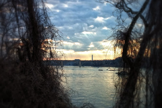
It’s quite a nice drive, actually. It cleaves closely to the course of the Shenandoah River, so you do get some nice views as you go, as well as access to Shenandoah River State Park, which I’ve mentioned before.

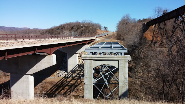
I spotted a historical marker on my left, and decided to stop and take a look. It’s a set of markers describing the historical bridge here, as well as the nearby town of Overall, which used to be called Milford, where a number of battles took place during the Civil War, the Valley Campaign of 1864. The battlefield itself is on private property, so other than the markers, there’s no point in me lingering.

Finally, I make it to the central entrance for Skyline, and of course, the North District is open again. I briefly consider heading north, but I’ve driven it before, and even though I’d like to see it again, I’ll settle for the central district.

After getting my passport stamped, I head in and stop at the first rest stop, which is also the trailhead for a short jaunt up to Mary’s Rock if one is so inclined. For about 30 seconds I entertain the notion of going for a quick hike up there, but as my hands start to go numb and my nose gets cold from the biting 20mph wind, I change my mind.

Sadly, this is a theme that repeats itself throughout the drive. I knew it was going to be too cold because of the forecast, but you know, if the opportunity presented itself I’d at least try. It was way too cold to try.

So, I had to be satisfied with seeing the park from the comfort of my warm car, with occasional jaunts outside to take some pictures.

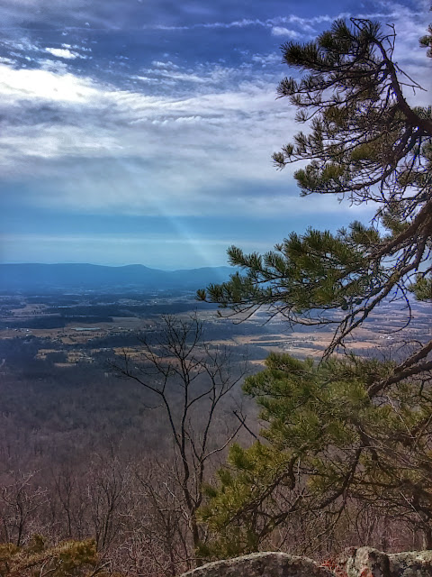
It is fun to drive along and see some of the parts of Skyline that I’ve only seen a few times from crossing it on foot. It showed me a different perspective, and it brought a smile to my face every time I recognized a crossing. Same thing with the overlooks. It was great to see Old Rag again from high up.

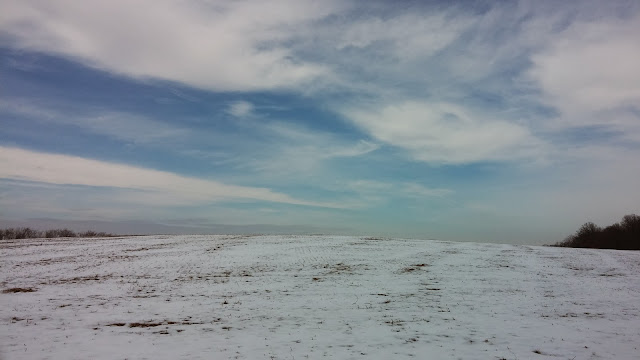
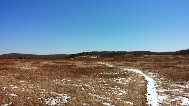
It was also nice to finally see Big Meadow, even though the visitors center and campgrounds were all closed, and the wind was still much too cold and bitter. I was able to get out of my car for a little bit, and I ventured out and looked around some. It looked lonely, but I’d love to take a weekend and stay at the lodge, and be able to wander the meadow.

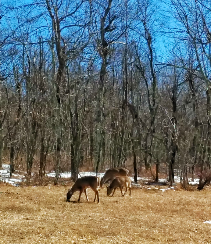
Back in the car and driving along, seeing the snow scudding along the road, swirling and making little snow devils. I see a few deer occasionally and slow down. They have no fear of me or my car whatsoever. They’re almost tame.

I can’t wait for spring to finally get here. I’m tired of the winter.

Eventually I hit the southern entrance of the central district. Part of me wants to keep going, to head a little further. But I was advised that not all of the southern district is open anyway, there were some road hazards. So, homeward I head.

Skyline 02/27/14

ODH Training Hike #3 – Northwest Branch and Sligo Creek

Posted on

Hike Summary

This was an extraordinarily long hike, but it was very enjoyable. It started out extremely cold, but as the day wore on it became very nice. I’m glad my backpack was mostly empty, because I had several layers that needed to be shoved into it.

On the first section of the hike I wished that I had my hiking boots and walking stick, as it was pretty much cross country type terrain, but the latter 2/3 of the hike I was glad I didn’t have them, as it was mostly paved. This has caused me a little bit of discomfort today, I seem to have strained a tendon on the front of my ankle and am trying to take things easy.

I’m very glad I was able to keep with the group, as I would have been lost without people that knew where they were going. There’s a lot of turns and detours on this route.

I met quite a few great people that I hope to see again at the upcoming training hikes. It also motivated me to join the Mid-Atlantic Hiking Group, as a couple of the hikers are hike leaders for that group and invited me to join them on their full hike of the Bull Run Occoquan Trail.

I wish I had time to stop and take more pictures, that’s the one disadvantage of these training hikes. One is so focused on getting the pace and miles in, it’s hard to really stop and take time to look around.

Product Review – Panache Sports Bra

Posted on

This is an unsolicited product review. If I am ever in the business of solicited product reviews, I’ll be sure to post a disclaimer.

Attention: This is a post about bras. If you don’t like bras, or don’t care about bras, probably best to skip this and move on.

So, the Panache Sports Bra. I ran across a review for this thing at a very nice blog, Weirdly Shaped. I liked the review so much, and after looking around at a few other blogs, I decided to give it a go for myself.

One of the problems I had pretty much since puberty is the curse of being  endowed with, as my mother likes to call them, “The Patterson Boobs.” All the women in my family have large assets. Correspondingly, a lot of women in my family also have back pain, as well as the “my eyes are up here” problem.

It was even worse when I was 100 pounds heavier than I am now, I was up to a size 42G at one point, which isn’t pretty on a person that is only 5’6″. Nowadays I bounce between a size 34 and a size 36 F, depending on the manufacturer.

Most bra manufacturers only go up to size DDD, and sports bras? Yeah forget it. A friend of mine mentioned resorting to just wearing multiple sports bras to get any sort of support. Running is something I’ve never gotten into for this reason.

It can even get pretty bad with hiking, especially in the summer when things get hot and sweaty, because things … get hot and sweaty. This is doubly the case here in the Mid Atlantic area, where there’s lots and lots of humidity keeping things damp.

Anyhow, to this bra. Panache makes bras exclusively for D cups and above, which is a great thing to see, because so many bras out there are either made for “plus size” (large band and large cup) or “normal” size (smaller band and smaller cup.) It is exceedingly difficult to find bras for those that fall in the middle, the smaller band and larger cup size.

I decided to get something colorful, but not extremely colorful, so I went with the grey one, which is more of a purple tinted grey, with a darker purple grey. Something a little different, but not too different.

Advice from bloggers and Amazon reviews suggested getting one on the smaller size, so I went with a 34F.

When I got it out of the box, my first impression was one of substance. This thing is built like a tank. It practically stands up by itself, with multiple layers and hefty sewing on the seams. Nice, solid construction. It almost worried me that it would be too bulky, but once I got it on, that bulk disappeared, and it fit great, extremely comfortable. It’s substantial enough that one could wear it on it’s own as a top, even, something that I may have to experiment with some summertime.

So far, I have worn it on a 5 mile, a 17 mile, and a 19 mile hike, and it’s performed admirable in all those situations. The 17 mile hike was the warmest, and the wicking properties of the fabric kept me cool and dry throughout the day.

I would definitely recommend this bra to anyone who has a large bust and needs a bra for any sort of exercise. It’s supportive enough that it almost makes me want to run. If I could afford it, I’d own one in each color. A+

ODH Training Hike #2 – C&O Canal at Pennyfield Lock

Posted on

Hike Summary

It was very cold. So cold that the friends I made at the previous hike didn’t go.

I kinda don’t blame them, in retrospect.

Still, there was a pretty good handful of people there, and I managed to get 19.12 miles under my belt.

Lessons learned:

  • Either the new socks I got worked great, or the dirt/gravel surface was kinder. Possibly both!
  • Make sure, when it is cold, to keep one’s chin covered. I got frost nip or wind burn on my chin and a lot of peeling a couple of days later.
  • I was in this odd nowhere zone of being too slow compared to one group, and too fast compared to another, so I spent a majority of my hike on my own, which was a little bit lonely. I am glad I packed my headset though, and listened to a good chunk of audiobook. At the end of the time my headset was on low, so if I need to use it on the ODH, I’ll have to keep that in mind.
  • I drank almost all of my water, even though it was cold.
  • There’s always pretty things to see on the C&O. It’s much harder to stop and take pictures when you’re trying to get miles, though.

I hope the snow that we had all melts by next Saturday!